Vereinigte Staaten
(USA): thematische Übersicht

Schnell-Navigation
![]() Staaten, politische Grenzen, Verwaltung
Staaten, politische Grenzen, Verwaltung
|
|
||
|
|
||
|
(Signatur) |
7200-K1 Topographic Series
1:24.000,
1:50.000, 1:63.360, 1:125.000, 1925-50.
7200-K6 Alasca: Topographic Series
1:250.000,
1950 ff.
7200-K7 United States: topographic Map
1:250.000.
7200-K9 Chicago Areal Geologic Map
1:24.000,
1930-1934.
+7200-K10 Sectional Aeronautical Chart
(Fliegerkarte)
1:500.000, 1949.
+7200-K11 Local Aeronautical Map
(Fliegerkarte)
1:250.000, 1949.
7200-K13 Geological Map of California
1:250.000,
1955/60.
7200-K15 Geological Map of Utah
1:250.000, 1963.
7200-K16 Gravity Map of California
1:250.000, 1968.
+7200-K18 Geologische und hydrologische Karte Minnesota
1:250.000,
1966-1990. (stehen im Gang)
7200-K19 One Hundred Topographic Maps
(mit Erl.) illustrating specified physiographic features.
+7200-K21 Geological Map of Alaska
1:250.000, 1964
ff.
7200-K22 Timber Stands and Vegetation
Elements.
+7200-K24 Bridge BackwaterInvestigaton
Projekt (Hydrological Investigaton Atlas), 1979.
7200-K25 Preliminary Geological Map of
California
1:24.000.
7200-K26 Floods (Hydrological
Investigation Atlas)
diverse Maßstäbe, 1960 ff.
+7200-K34 Road Map
1:500.000.
+7200-K35 Nationalparke
diverse
Maßstäbe.
7200-K36 Land Use and Land Cover
1:250.000, 1:100.000, 1978.
+7200-K37 Roadmap.
7200-K38 Topographischer Atlas
diverse
Maßstäbe, 1980 ff.
7200-K39 Hydrologisch/ Hydrographische Einheiten USA
(Hydrologic Units)
1:500.000,
1974.
7200-K40 Hydrologie USA; diverse Themen und Regionen (nach
Bundesstaaten geordnet)
+7200-K41 USA:
Topographie
1:100.000,
1980 ff.
+7200-K42 USA: Aeromagnetic Map of Minnesota
1:100.000,
1998 ff.
7200-K43 USA: Topogr. Karten der einzelnen Bundesstaaten
1:500.000,
1951.
|
|
||
|
|
||
|
(Signatur) |
7200-1 USA:
Topographie.
1:5
Mill., 1959.
7200-2 Vereinigte
Staaten: Reliefkarte.
1:7,5
Mill., Hamburg 1951.
7200-3 Etats-Unis: Monts Appalaches
et Grands Lacs Canadiens.
1:3 Mill., Paris 1904.
7200-4 USA
westlich des Mississippi: Übersichtskarte.
1:2
Mill., 3 von 6 Teilen vorhanden.
7200-5 USA:
Kordillieren Südkaliforniens.
1:2,5
Mill.
7200-6 USA:
Gebiete des 40. Breitengrades in den Kordillieren.
O.
M., 6 Teile einer alten Karte mit Bauplanung der Transkontinentaleisenbahn.
7200-7 USA/Kanada:
New Brunswick – Rhode Island. Seekarte.
O. M., 1886.
7200-8 USA: Rhode Island – Long
Island Sound– New York: Seekarte.
O. M., London
1886.
7200-9 USA: New Port to Long
Island.
O. M., 1900.
7200-10 USA: Maine. Kennebec and
Sheepscot Rivers. Seekarte.
1:40.000, 1874.
7200-11 USA: Sapelo Sound – Little
Bahama Bank. Seekarte.
O. M., 1884.
7200-12 USA: Florida. Long Key Reefs.
Seekarte.
1:80.000, 1895.
7200-13 USA: Florida. Key West Reefs. Seekarte.
1:80.000,
1907.
7200-14 USA:
Golfküste. Key West. Seekarte.
1:400.000, 1906.
7200-15 USA: California. San Diego –
Los Angeles – Conception Point. Seekarte.
O. M., 1883.
7200-16 USA: Westküste. San Francisco.
Seekarte.
1:200.000, 1908.
7200-17 USA: Johnstone and Broughton
Straights.
O. M., 1899.
7200-18 USA: Mount Hull - Golden Gate.
Photographische
Rekonstruktion.
O.
M., o. J.
7200-20 USA:
Utah – Fish Springs. Blatt eines älteren Kartenwerks.
1.250.000,
1919/20.
7200-21 USA:
Colorado Springs und Umgebung.
1:48.000,
1909/21.
7200-22 USA: Utah – Bingham Mining.
1:20.000, 1901/17.
7200-23 USA: California – Kern River
Oil Field.
1.12.500, 1915, 2
Teile.
7200-24 USA: Southern California.
1:250.000,
1904/24, 3 Teile.
7200-25 USA: California – Salton Sink.
1:500.000, 1908.
A7200-26 USA: SE-Alaska. Küstendistrikt.
1:1,2
Mill., Petermanns Geogr. Mitt. 1894.
A7200-27 USA: Alaska. Katmai Naturschutzgebiet und Umgebung.
1:650.000, Leipzig
o. J.
A7200-28 USA: Alaska. Contoller Bay
Region.
1:250.000,
1905.
7200-29 USA: Mount Rainier. Nisqually
Gletscher.
1.10.00, München
1953.
7200-30 USA: Washington State: Mount
Baker District.
1:250.000,
1915/17.
7200-31 USA: California. Lassen
Volcanic National Park.
1:48.000, 1929/49.
7200-32 USA: California. Sequoia and
Kings Canyon National Park.
1:125.000,
1948/52.
7200-33 USA: Montana. Glacier
National Park.
1:125.000,
1938/41.
7200-34 USA: Idaho. Crates of the Moon
National Park.
1:31.680, 1933/47.
7200-35 USA: Yosemite National Park.
1.125.000, 1947.
7200-36 USA: Tennessee/North Carolina.
Great Smoky Mountains National Park.
1:62.500, 1947.
7200-37 USA: Virginia. Shenandoah
National Park.
1:62.500, 1934.
7200-38 USA: Washington. Mount Rainier
National Park.
1:62.500, 1929/47,
2 Ex.
7200-39 Wyoming: Grand Teton National
Park.
7200-40 Wyoming-Montana-Idaho:
Yellowstone Ntl. Park
1:125.000, 1951.
7200-41 Alaska: Yanert Fork Fairbanks.
7200-42 Alaska: Chichagof and Baranof
Islands
1:250.000, 1942.
7200-43 Alaska: Central Richardson Highway.
7200-44 Alaska: Goodbews District
1:25.000, 1938.
7200-45 Alaska: Chitina Valley
1:250.000, 1942.
7200-46 Alaska: Kamishak Bay and
Katmai Region
1:250.000, 1938.
7200-47 Alaska: Kanatak District
1:250.000, 1935.
7200-48 Alaska: Kodiak and Vicinity
1:250.000, 1933.
7200-49 NW-Alaska: reconnaissance Map
1:500.000.
7200-50 Alaska: Prince William Sound
Region
1:62.500, 1937, 2
Expl.
7200-51 Alaska: Wrangell District
1:250.000, 1932, 2
Exl.
7200-52 Alaska: Kotsina-Kuskulana
District
1:62.500, 1939.
7200-53 Alaska: Prince of Wales Island
1:250.000, 1947.
7200-54 Alaska: Pavlof District
1:250.000, 1937.
7200-55 Alaska: Nushagak District
1:250.000, 1940.
7200-56 Arizona: Grand Canyon National
Park
1:48.000, 1948, 2
Teile.
7200-57 State of Illinois: Top. Übersicht
1:500.000, 1927
7200-60 Kalifornien
und Nevada: alte top. Karte
1:1,1
Mio., 1874.
7200-61 USA:
6 Teile eines Kupferdrucks auf Leinen
1.3,7 Mio.,
1882.
7200-62 Washington: Great Smoky
Mountains Ntl. Park
1:125.000,
1950.
7200-63 Alaska:
alte Übersichtskartemit Eintragung der Goldminen am oberen Yukon
1:9,5 Mio.,
1897.
7200-65 Pennsylvania and New Jersey:
Physical Map (mit Höhenlinien und Schummerung)
1:500.000, o.J.
7200-66 Utah: State of Utah
1:500.000,
Washington, 1959.
7200-67 USA: Classes of Land- Surface
from the 48 States
1:5 Mio., Wisconsin, 1963.
+7200-68 USA und einige thematische Nebenkarten
1:6 Mio., 1965.
+7200-69 IRO-Karte Nordamerika
1:5 Mio., 1960.
7200-70 USA: Nevada, top. Karte
1:500.000,
Washington, 1962/65.
7200-71 Top.
Karte der Umgebung von San Francisco/ Oakland.
7200-72 San FranciscoBay Region
1:125.000, 1970, 2
Bl.
7200-73 Great Sand Dunes National
Monument
1:24.000, 1967.
+7200-74 Pikes Peak and Vicinity, Colorado
1:62.500, 1956
7200-75 Standard Map USA
1:5 Mio.
+7200-77 Northeastern United States ,
Land and Submarine Topography
1:1 Mio., 1939.
+7200-78 The Topographic Maps of the US: eine Karte als
Beispiel zur Herstellung top. Karten in den USA.
7200-79 Alaska:
Topographie: Nabesna (3 Bl.), Mc Carthy (2 Bl.),
1:63.360.
7200-80 Physiographic Diagram of the
USA
1:9 Mio., 1:19
Mio., 1932.
7200-81 Physiographic Diagram of the
Driftless Hill Lands
ca. 1:516.000.
7200-82 Landforms of the United States
1:9,1 Mio., 1:12,5 Mio., 1939.
7200-83 Übersichtskarte
mit Staatsgrenzen und Gewässernetz.
7200-84 Städte
und Flüsse Alaskas
1:5
Mio.
7200-85 Topographic Map of the Niagara
Falls
1:12.000, 1909.
7200-86 US-Contour Map
1:11 Mio., 1911.
7200-87 US-Relief Map
1:11 Mio., 1911.
7200-88 Yosemite National Park
1:125.000, 1909.
+7200-89 Los Angeles: Metromap.
7200 - 92 Tennessee Atlas (&
Gazetteer), 1997
1:150.000.
7200 - 93 Grand Canyon: 3-D-Karte mit 3D-Brille, o. J.
1:62.500.
7200-94 USA:
physische Karte, 1959.
7200-95 USA:
physische Karte, 1915.
|
|
||
|
|
||
|
(Signatur) |
7201-1 Die
Vereinigten Staaten, Kupferdruck, Stieler, 1834.
7201-2 NE-Staaten,
Kupferdruck, Stieler, 1832.
7201-3 USA:
Übersichtskarte, Staaten flächenhaft koloriert, 1867, 2 Expl.
7201-4 USA:
Übersichtskarte, 1883.
7201-5 USA:
Staaten in Flächen- und Bandkolorit.
7201-7 USA:
Verwaltungsgrenzen
1:2,5
Mio., Stuttgart, 1951, 2 Teile.
+7201-8 Haack
Handkarte: Nordamerika
1:4
Mio., 1980.
7201-9 USA:
Verwaltungskarte, 6-farbig
1:5
Mio., 1957.
|
|
||
|
|
||
|
(Signatur) |
7203-1 USA including Alaska and
Hawai: Recreational Areas
Washington, 1934.
7203-2 USA: Generalized Types of
Framing (Hrsg. US Department of Agriculture), 1949.
7203-3 USA: Major Land Use (Hrsg.
US Department of Agriculture), 1950/58.
7203-4 USA: Location of Irrigated
Land 1949, 1n 17 western states and Arkansas, Louisana and Florida.
7203-5 Utah: Location of irrigated
Land 1949, mit Statistik.
7203-6 Arkansas: " "
7203-7 Texas: 2 Teile " "
7203-8 South Dakota: " "
7203-9 Oklahoma: " "
7203-10 North Dakota: " "
7203-11 Nebraska: " "
7203-12 Montana: " "
7203-13 Louisana: " "
7203-14 Kansas: " "
7203-15 California: " "
7203-16 Wyoming: " "
7203-17 Idaho: " "
7203-18 Population Distribution: Urban
and Rural in the USA
1:10 Mio.,
Washington, 1960.
7203-19 California Population
Distribution in 1960
1:1 Mio.
7203-20 Honolulu:
Baumaterial und Baubestand, Funktionale Gliederung
Erdkunde
31,2, Kreisel.
7203-21 USA:
Population Distribution, versch. Bundesstaaten, 1932.
|
|
||
|
|
||
|
(Signatur) |
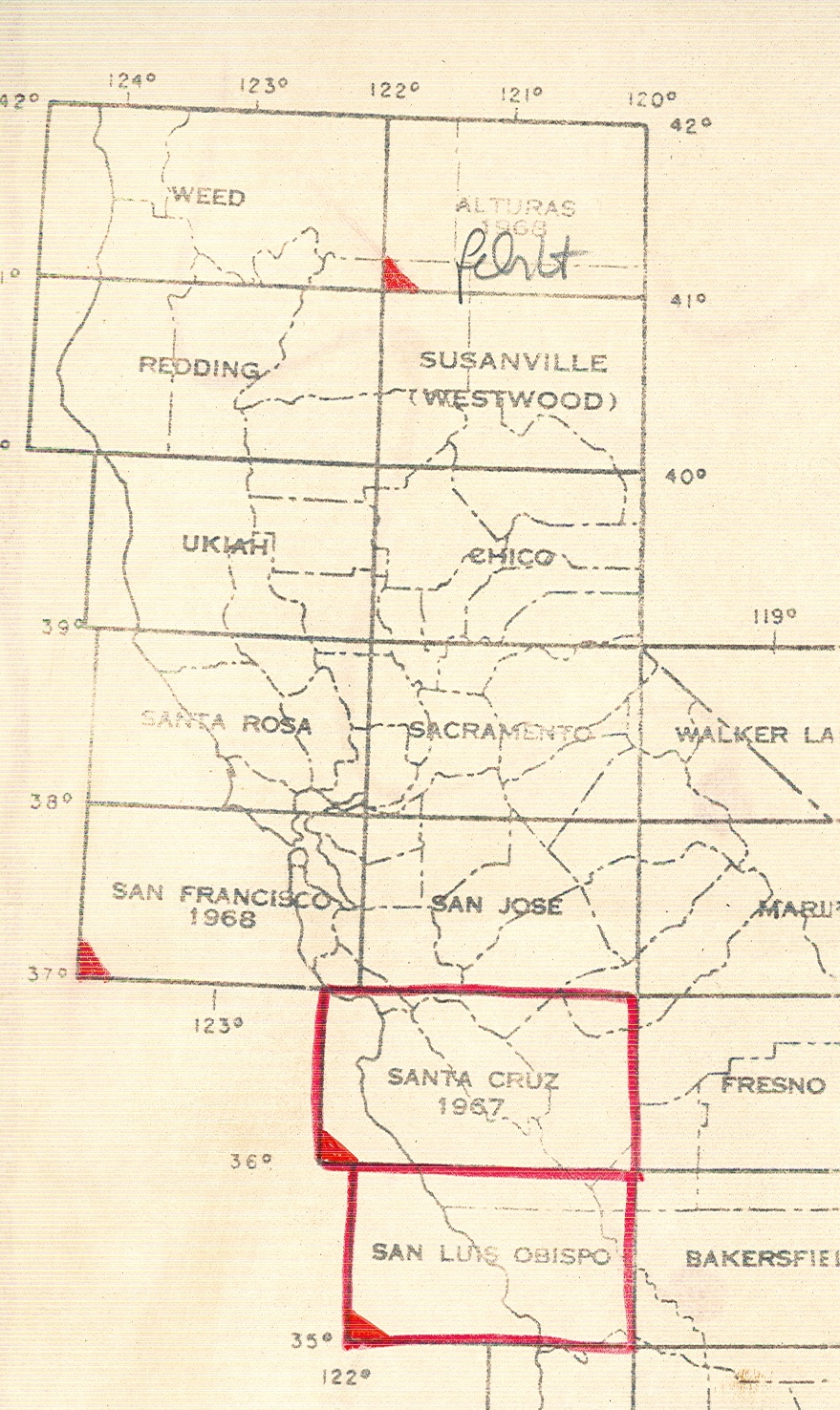
7204-1 California, San Luis
District: Geological Atlas
1:125.000, 1904.
7204-2 California, Santa Cruz:
Geological Atlas
1:125.000, 1909,
(siehe: 7204-1).
7204-3 Colorada, La Plata:
Geological Atlas
1:62.500, 1899,
(siehe: 7204-1).
7204-4 Colorado, Pueblo: Geological
Atlas
1:125.000, 1897,
(siehe: 7204-1).
7204-5 Colorado, Tenmile:
Geological Atlas
1:31.680, 1898,
(siehe: 7204-1).
7204-6 Philadelphia: Geological
Atlas.
1:62.500, 1909,
(siehe: 7204-1).
7204-7 Nebraska, Scotts Bluff:
Geological Atlas
1.125.000, 1903,
(siehe: 7204-1).
7204-8 New Jersey-Pennsylvania,
Trenton: Geological Atlas
1:125.000, 1909,
(siehe: 7204-1).
7204-9 North Carolina-Tennessee,
Mt. Mitchell: Geological Atlas
1:125.000, 1905,
(siehe: 7204-1).
7204-10 Tennessee, Morristown:
Geological Atlas
1:125.000, 1896,
(siehe: 7204-1).
7204-11 Tennessee, Maynardsville:
Geological Atlas
1:125.000, 1901, (siehe
7204-1).
7204-12 Texas:
Topographischer Atlas
1.125.000,
1900, mit Abb. und Erl.
7204-13 Texas, El Paso: Geological
Atlas
1.125.000, 1909,
(siehe: 7204-1).
7204-14 Wyoming, Yellowstone Ntl.
Park: Geologischer Atlas (siehe: 7204-1)
1:125.000, 1896.
7204-15 Wyoming, Laramie-Sherman:
Geolog. Atlas (siehe: 7204-1)
1:125.000, 1910.
7204-16 Allegany County: Physical
Atlas
1:62.500, 1900.
7204-18 California, Healdsburg and
Russian River: Soil Map.
O. M., 1915.
7204-19 Rocky
Mountains: Geologische Aufnahme für den Bau der Transkontinentalbahn.
O.
M., 10 Teile, (vgl.: 7200-5, 7200-6).
7204-20 New
Mexico: Geologische Übersicht in zwei Teilen.
1:500.000,
1928.
7204-21 Colorado:
Geologische Übersicht in zwei Teilen.
1:500.000,
1935.
7204-22 Illinois:
Geologische Übersicht.
1:500.000,
1945.
7204-23 Idaho:
Geologische Übersicht.
1:500.000,
1947.
7204-24 Kansas:
Geologische Übersicht.
1.500.000,
1937, 3 Ex.
7204-25 South
Dakota: Geologische Übersicht.
1:500.000,
1951.
7204-26 Iowa:
Geologische Übersicht.
1:500.000,
1937.
7204-27 West
Virginia: Kohle, Öl und Gas.
1:506.771, 1
inch to 8 miles, Morganntown 1904.
7204-28 Montana: Öl und Gas.
1:500.000, USA 1944, 2 Teile.
+7204-29 USA: Oberflächenformen und natürliche Landschaften.
Sonderausgabe
mit Reiserouten des Internat. Geogr. Kongresses.
O.
M., Washington 1952.
7204-30 Alaska:
Geologische Karte.
1:2,5 Mio.,
1954.
+7204-31 Eastern North America: 3 Water
Balance Maps.
Mean Annual Water
Deficit.
Mean Annual Water
Surplus.
Mean Annual
Potential Evapotranspiration.
1:5 Mio., 1958.
7204-32 Alaska:
Topographische Karte mit besonderer Reliefschummerung.
1:2,5 Mio.,
1954.
7204-33 Kansas: Mineral Resources.
1:633.464, 1 inch
to 10 miles, 1951.
7204-34 Kansas Pits and Quarries.
O.M., 1951.
7204-35 Southeastern Kansas: Map of
Mined Areas of the Weir Pittsburgh Coal Bed.
O. M., Bull. 52,
Part 5, =Y120, (Abernathy), 1944.
7204-36 Southeastern Kansas: Map
showing Geological Structure of Coal
Fields of
Zinc-Lead District.
O. M., 1935.
7204-37 Kansas, Labette County: Oil
and Gas Exploration Map.
O. M.,
(Abernathy), 1939.
7204-38 Kansas: The Surface Features.
O. M., (R. C.
Moore), o. J.
7204-39 Kansas: Graphic Column of
Kansas Rocks.
O. M., Bull. 89,
=Y120, 1952.
7204-40 USA: Physical Division,
illustrating specified physiographic features.
1:7 Mill., (N. M.
Fenneman), 1957.
7204-41 USA: Forest Regions.
O. M., Washington
1960.
7204-43 USA: Gulf Coast. Seekarte.
1:470.000, Coast
and Geodetic Survey 1961.
7204-44 USA: Gulf Coast. Cape St.
Georges to Mississippi.
1:456.000, Coast
and Geodetic Survey 1962.
7204-45 USA: Gulf Coast. Tampa Bay to
Cape St. Blas (Florida).
1:456.000, Coast
and Geodetic Survey 1960.
7204-46 USA: Gulf Coast. Galveston to
Rio Grande.
1:460.000, Coast
and Geodetic Survey 1961.
7204-47 USA: Gulf Coast. Mississippi
River to Galveston.
1:458.000, Coast
ans Geodetic Survey 1961.
7204-48 Kalifornien: Map of Yosemite
Valley.
1:24.000, 1927.
7204-49 USA: Gulf of Mexico.
1:2.161.530, 1961.
7204-50 USA: Water Resource
Development.
1:2,5 Mill., 1963.
7204-51 Kansas: Oil and Gas Fields.
1:500.000, 1962. Text unter Y 120/166; vgl. 7207-12.
7204-52 Alaska:
Geologische Karte.
1:1,5 Mill.,
1964.
7204-53 Arizona: Normal Annual
Precipitation and Normal May-September Precipitation.
1:500.000,
1931-1960.
7204-54 Normal October-April
Precipitation.
1:500.000,
1931-1960.
+7204-55 Geology of California.
versch. Maßstäbe,
10 Blätter.
+7204-56 Geology of California. Preliminary
reports.
+7204-59 Geological Map of Minneapolis.
1:24.000, Teil
1-6.
+7204-60 Surficial Geology of the New
Brighton Quadrangle.
1:24.000. siehe 7200-K 18.
7204-61 USA: Occurence of Petroleum
& Natural Gas Reservoir Rocks.
7204-62 Kansas: Geology and
Groundwater in Labette County.
7204-63 Oregon: Pattern of Runoff in
the Willamette Basin.
1:500.000, 1968.
7204-64 Colorado: Rocky Mountains
National Park.
1:625.000, 1961.
+7204-65 Northwestern North America: 9
Glacier Maps.
1:10.000, 1960.
7204-66 Arizona: Geologic Map.
1:500.000, 1969.
7204-67 Montana: Geologic Map.
1:500.000, 1955.
7204-68 USA: Geologic Quadrangle Maps.
1:24.000, 1971.
+7204-69 Utah: Geologic Map.
O. M., 1966.
7204-70 New Mexico: Geologic Map.
1:500.000, o.J.,
und Erl.
+7204-71 West of Oregon 121 st. merid.:
Geologic Map.
1:500.000, o.J.
+7204-72 San Luis Obispo Sheet: Geolog. Karte.
1:250.000,
1971, und Erl.
+7204-74 Alaska: Permafrost Map.
1:2;5
Mill., 1965, 2 Expl.
7204-78 USA:
Geologic Map.
1:2,5
Mill., 1974, 3 Bl.
+7204-83 Topographic Maps: Arbeitswege zur Herstellung top.
Karten.
O.M.,
o.J.
+7204-84 1) Kamsas: Areal Geology of Elk
Country. State Geological Survey of Kansas Vol. 14, Plate 1-3.
2) Oil and Gas
Resources.
3) Ground Water
Resources.
O.M., 1949.
7204-91 Florida: Springs of Florida,
Map of Florida Showing Location Springs.
1:1 Mio., 1940.
7204-92 Florida: Forest Map and
Hydrologic Conditions, Apalachicola River Flood Plain, by H.M.Leitman, aus:
Hydrological Investigations Atlas, HA-672.
O.M., 1984.
7204-93 Alaska: National Forests and
Several Typs of Reservations (Military, Naval, and Indians).
1:2.670.000, 1927.
7204-94 North America: Natural Forests
Regions of North America.
O.M., 1910.
7204-95 Wisconsin: Geologic Map.
1:1.000.000,
o.J.
7204-96 USA: Natural Forests of the
USA.
1:6.000.000, 1913.
+7204-98 USA: Preliminary Map of the
Conterminous United States Showing Depth and Quality of Shallowest Ground Water
Containing More
Than 1000 ppm Dissolved Solids, aus: Hydrological Investigations Atlas, HH-199.
O.M., 1965.
+7204-99 Minnesota: Major Constituent
Chemistry of Selected Phanerosoic Aquifers in Minnesota, aus: Minnesota
Geological Survey.
O.M., 1986.
+7204-100 California: Earthquake Faults of
California.
ca. 1:8 Meilen,
1980.
+7204-101 California-Nevada: Pacific
Southern Region: Geological Highway Map.
ca. 1:30 Meilen,
1962.
+7204-103 Utah, Colorado, New Mexico,
Arizona: Southern Rocky Mountain Region: Geological Highway Map.
1:170.000, 1990.
7204-104 Utah, Capitol Reef National Park: Geologische Karte
1:62.500;
4 Blätter + 1 Textblatt, 1987.
7204-105 Potential natural Vegetation
1:7.500.000.
7204-106 Distribution of principal kind
of soils
1:7.500.000.
+7204-107 New Mexico: Vegetation and Landuse
1:1.000.000; 1977.
+7204-108 Nebraska: Vegetation
1:1
Mio., 1975.
+7204-109 Kansas: Potential natural Vegetation
1:800.000;
1973, mit Erläuterungen.
+7204-110 Utah: Bodenkarte
1:100.000,
1973, mit Erläuterungen.
+7204-111 South Carolina: Bodenkarte
1:750.000;
1979.
+7204-112 Kansas: Bodenkarte
1:1.125.000;
1973.
+7204-113 Connecticut: Bodenkarte
1:250.000;
1978, mit Erläuterungen.
+7204-114 Wisconsin: Bodenkarte
1:710.000;
1968.
+7204-115 Arizona: Natural vegetative communities
1973.
7204-116 Arizona: Bodenkarte
1:1.Mio.
+7204-118 Appalachian Region (Pennsylvania
bis Alabama): Water Resources
1:310.000; 1968,
Sheet 1von 4.
7204-119a Grand-Water Atlas of the USA:
Californien, Nevada
o.M.
7204-119b G.W.A.: Arizona, Colorado, New
Mexico, Utah
o.M.
7204-119c G.W.A.: Illinois, Indiana,
Kentucky, Ohio, Tennessee
o.M.
7204-119d G.W.A.: Oklahoma, Texas
o.M.; 1996.
7204-125 G.W.A.: Montana, North + South
Dakota, Wyoming
o.M.
+7204-126 Hydrographical Basin of the
Mississippi River(1843)
o.M.; the
Minnesota Historical Society, 1976.
|
|
||
|
|
||
|
(Signatur) |
7206-2 Vereinigte Staaten:
Verkehrsübersicht
1:5.Mio; Leipzig,
1935.
7206-3 Pennsylvania: Highways
o.M.; Harrisburgh,
1950.
A7206-4 Vereinigte Staaten:
Straßenatlas
o.M., Chicago,
1952.
+7206-5 USA, Kanada, Mexico:
Straßenatlas
o.M.; 1986.
A+7206-6 North Central States:
Straßenkarte
1 inch = ca. 27
Miles, 1950.
+7206-7 New England States:
Straßenkarte
1 inch = ca. 23
Miles; 1950.
A+7206-8 Eastern United States:
Straßenkarte
o.M.; 1950.
A+7206-9 North Atlantic States:
Straßenkarte
1 inch = ca. 23
Miles; 1950.
A+7206-10 East Central States: Straßenkarte
1 inch = ca. 27
Miles, 1950.
A+7206-11 Southern New England: Straßenkarte
1 inch = ca. 7,4
Miles, 1950.
A+7206-12 New England: Straßenkarte
1:687.000, 1952.
A+7206-13 Washington D.C.
a) Stadtplan, o.M.
b) Straßenkarte der Umgebung, 1 inch = 1,15
Miles.
A+7206-14 Pennsylvania: Straßenkarte
1 inch = ca. 9,5
Miles, 1952.
A+7206-15 North + South Carolina:
Straßenkarte
1 inch = ca. 15,5
Miles, 1952.
A+7206-16 Delaware, Maryland, Virginia, West
Verginia: Straßenkarte
1 inch = ca. 15
Miles; 1952.
A+7206-17 Georgia, Alabama: Straßenkarte
1 inch = ca. 8
Miles, 1951.
A+7206-18 Iowa: Straßenkarte
1 inch = 15 Miles
1950.
A+7206-19 New Hampshire: Touristenkarte
1 inch = ca. 8
Miles, 1950.
A+7206-20 Maine: Straßenkarte
1 inch = ca. 13
Miles, 1950.
A+7206-21 Wisconsin: Straßenkarte
1:1.Mio, 1953.
A+7206-22 Indiana: Straßenkarte
1 inch = ca. 8
Miles, 1951.
A+7206-23 Kentucky: Straßenkarte
1 inch = ca. 12
Miles, 1950.
A+7206-24 Minnesota: Straßenkarte
1 inch = ca. 6
Miles, 1953.
A+7206-25 Minnesota: Straßenkarte
1 inch = ca. 18
Miles, 1950.
A+7206-26 Kansas: Straßenkarte
1 inch = ca. 10
Miles, 1950.
A+7206-27 Kentucky: Straßenkarte
1 inch = 19,4
Miles, 1950.
+7206-28 Eastern United States: Straßenkarte
1:2.2 Mio.
+7206-29 Los Angeles Area: Straßenkarte
ca. 1:1,1 Miles,
1991.
+7206-30 USA: Straßenkarte
1:4 Mio, 1995.
|
|
||
|
|
||
|
(Signatur) |
7207-2 California: Öl- und
Gasfelder
1:506.880, 1923.
7207-3 Illinois: Coal Mines
1:500.000, 1947.
7207-4 Illinois: Öl- und Gasfelder
1:500.000, 1948,
Beiblatt 1921.
7207-5 Pennsylvania: Öl- und
Gasfelder
1:500.000, 1921.
7207-6 West Verginia: Öl- und Gasfelder
1:500.000, 1922.
7207-7 Louisiana: Öl- und Gasfelder
1 inch = 12 Miles,
1921.
7207-8 Kentucky: Öl- und Gasfelder
1:500.000, 1922.
7207-9 San Francisco: Bebauungsplan
des Stadtbereiches
o.M., Dep. of
City/Planning, 1948.
7207-10 Coal Fields of the United
States
1:5.Mio,
Washington, 1960.
7207-11 Gulf Coast Area: Oil and Gas
Journals
o.M., Tulsa,
1939.
7207-12 Kansas: Öl-und Gaspipelines +
Industrie
1:500.000,
University of Kansas, 1963.
|
|
||
|
|
||
|
(Signatur) |
7209-1 San Francisco und Umgebung
1:62.500, 1915,
Zusammendruck einer top. Karte.
7209-2 Washington und Umgebung
1:63.680, 1927/51.
7209-3 Washington-Mitte und
Vorstädte
1:63.360.
7209-4 New York: Hafen
o.M., 1952.
7209-5 Portland-Vancouver und
Umgebung
1:24.000, 1954.
7209-6 New
York: Top. Plan in 8 Teilen, 6Teile als Wandkarte
1:24.000.
7209-7 Oakland
und Umgebung
1:24.000,
1954.
7209-8 San
Francisco und Umgebung
1:24.000,
1954.
7209-9 Washington:
Plan D’enfants (1790)
o.M.,
Nachdruck.
7209-10 Boston
und Umgebung
1:24.000,
1962.
7209-11 Chattanooga
und Umgebung
1:24.000,
1958.
7209-12 Buffalo
und Umgebung
1:24.000,
1950.
7209-13 Gary
und Umgebung
1:24.000,
1953.
7209-14 Atlanta
und Umgebung
1:24.000,
1955.
7209-15 Butte
(Montana) und Umgebung
1:15.000,
1926.
7209-16 Los
Angelas: Topographie
1:24.000,
1900, 2 Blätter.
7209-17 Boston:
Topographie
1:62.500, 1919.
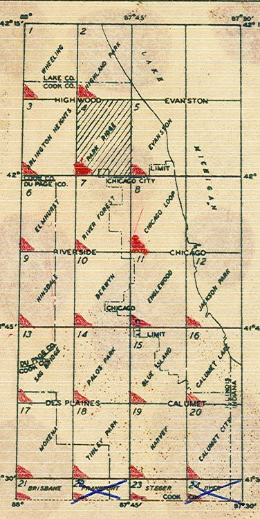
7209-18 Chicago: Topographie
1:24.000, 1957.
+7209-19 Baltimore: Topographie
o.M., 1967.
7209-20 Washington
und Umgebung
1:24.000,
1965.
7209-21 Detroit
(North and South): Topographie
1:24.000,
1952, 2 Blätter.
+7209-22 Detroit: Topographie
o.M., 1964.
+7209-23 Harlem: Topographie
1:50.000.
+7209-24 Chicago: Topographie
o.M., 1967, 1993, 2 Blätter.
+7209-25 New York: Topographie
o.M., 1968, 1993,
2 Blätter.
+7209-26 San Francisco: Topographie
o.M.
7209-27 Oakland
und Umgebung
1:24.000,
1957.
7209-28 Salt
Lake City und Umgebung
1:24.000,
1966.
7209-29 Long
Beach und Umgebung
o.M.,
1951.
+7209-30 New York: Topographie
o.M., 1984, 1995,
2 Blätter.
+7209-31 New York (Manhatten):
Topographie
o.M., ca. 1950.
+7209-32 Milwaukee und Umgebung
o.M.,
1934.
+7209-33 San Francisco und Umgebung
o.M.,
1992, 2 Blätter.
+7209-34 Tuscon und Umgebung
o.M.,
1992.
+7209-35 Las Vegas und Umgebung
o.M.,
1992, 2 Blätter.
+7209-36 Los Angelas und Umgebung
o.M.,
1992, 2 Blätter.
+7209-37 Phoenix und Umgebung
o.M.,
1992.
+7209-38 Oklahoma City und Umgebung
o.M.,
1993.
+7209-39 Minneapolis und Umgebung
o.M.,
1994.
+7209-40 Memphis und Umgebung
o.M.,
1991.
+7209-41 Boston und Umgebung
o.M.,
1991.
+7209-42 Atlanta und Umgebung
o.M.,
1991.
+7209-43 Detroit und Umgebung
o.M.,
1994.
+7209-44 Kansas City und Umgebung
o.M.,
1987.
+7209-45 New Orleans und Umgebung
o.M.,
1993.
+7209-46 Washington und Umgebung
1:15.000,
1995.
+7209-47 Atlanta und Umgebung
1:15.000,
1995.
+7209-48 Washington D.C. und Umgebung
1:40.000,
1995.