 Kanada: thematische Übersicht
Schnell-Navigation
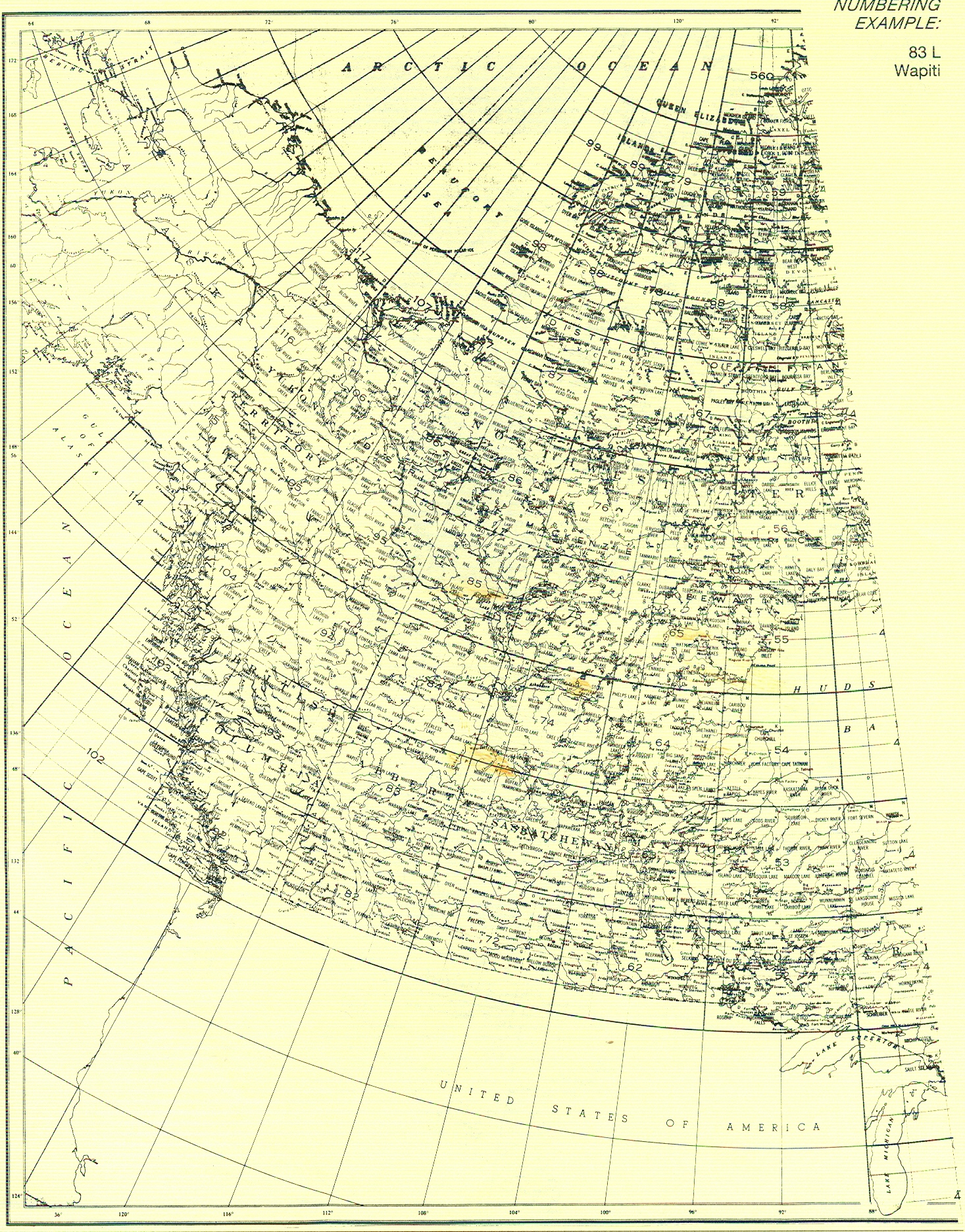
![]() Topographie
Topographie
|
|
||
|
|
||
|
(Signatur) |
7100-K2 British Kolumbien
1:63.500,
1909, 1Bl.
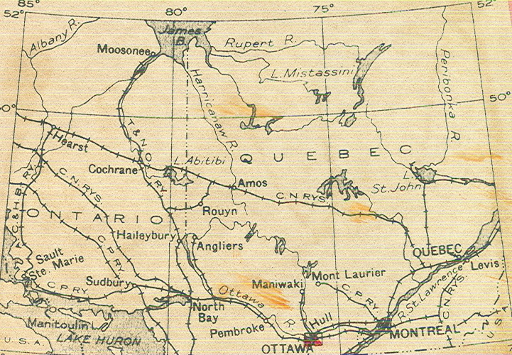
7100-K3 Kanada: National topogr Series
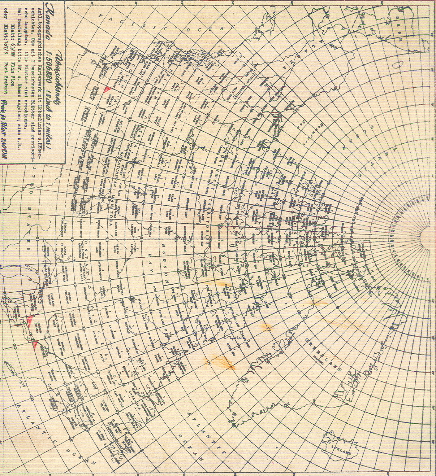
1:506.880
(8 Meilen=1 inch), 1940, 4 Bl.
7100-K4 Kanada: Geological Map
1:63.360
(1 Meile=1 inch), 1938, 2 Bl.
7100-K5 Kanada: National topogr. Series
1:126.720
(2 Meilen=1 inch), 1940, 1 Bl.
7100-K6 Kanada: National topogr. Series
1:253.440
(4 Meilen=1 inch), 1932/39, 2Bl.
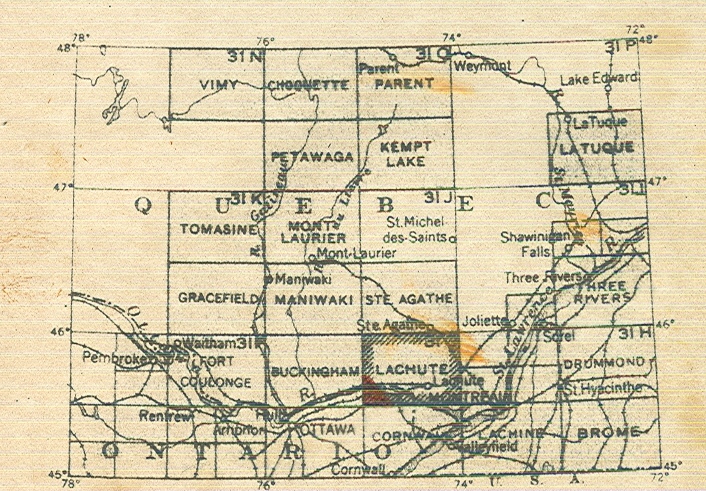
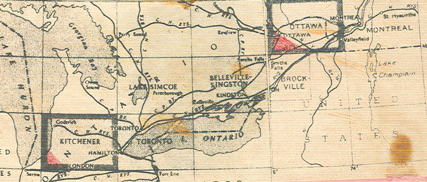
7100-K7 Kanada:
National topogr. Series
1:63.360
(1 Meile= 1 inch), 1940/48, 4 Blatt.
7100-K8 Kanada:
National topogr. Systems
1:50.000,
1960, 404 Blatt.
7100-K9 Kanada: Topgr. Karte
1:250.000.
+7100-K10 Nationalpark Karten
verschiedene
Maßstäbe 1:35.000-1:200.000, 1989.
|
|
||
|
|
||
|
(Signatur) |
7100-1 Dominion
of Canada, mit wirtschaftsgeogr. Eintragung, London, 1886
7100-2 Dominion
of Canada: Plan der Transkontinentaleisenbahn
1:6,336 Mio.
7100-3 Dominion of Canada and New
Foundland
1:5,5 Mio.,
London, 1903.
7100-4 Kanada: Topogr. Karte
1:5,8 Mio.,
Baltimore, 1936.
7100-5 Neufundland:
Bildkarte.
7100-6 Neufundland:
Eisenbahnkarte
1:1,2
Mio., Chicago, 1925.
7100-8 Britisch
Kolumbien
1:1,5
Mio., London, 1898.
7100-9 Britisch
Kolumbien
1:1,1
Mio., 1912, 4 Teile.
7100-10 Britisch
Kolumbien
1:1
Mio., 1903.
7100-12 Britisch
Kolumbien
1:4
Mio., 1912, 2 Teile.
7100-12 Canada:
Westteil der Übersichtskarte des nördlichen Kanadas
1:2
Mio., Ottawa, 1942-46.
7100-13 Kanada:
Übersichtskarte
1:6,3
Mio., 1951.
7100-14 Ostkanada:
Übersichtskarte in 2Teilen
1:2,2 Mio.,
Ottawa, 1941-42.
7100-15 Central-Canada: Übersichtskarte
1:2,851 Mio.,
1963.
7100-16 Manitoba and Northern Ontario
Region
1:2 Mio., 1965.
7100-17 Canada: Northwestern Region
1:4,5 Mio., 1965.
+7100-18 Canada
1:5,3 Mio., 1995.
+7100-19 Canada: topogr. Karte
1:6
Mio.
|
|
||
|
|
||
|
(Signatur) |
7101-1 Neufundland,
Nordteil: Seekarte, London, 1903.
7101-2 Neufundland,
Südteil: Seekarte, London, 1900.
7101-3 St. John/
Newfoundland-Halifax/ Nova Scottis: Seekarte, London, 1887.
7101-4 British
Columbia: Skizze der natürlichen Bedingungen.
7101-5 Kanada:
Geologische Übersicht.
1:6
Mio.
7101-6 Kanada:
Bodenschätze
1:6
Mio.
7101-7 Profil
Vancouver-Winnipeg.
7101-8 Kanada:
Geologische Übersicht, 1842-1882.
7101-10 Alberta:
Banff Nationalpark
1:190.080,
1932/46/55.
7101-11 Neufundland:
Geologische Übersicht, Handzeichnungen von Kirchberger.
7101-12 NW-Kanada: Lines of equal
magnetic declination and annual change in Canada for 1948
1:6,3 Mio.
7101-12 Kanada: Lines of equal
magnetic declination and annual change in Canada for 1948
1:6,3 Mio.
7101-13 Kanada:
Geologische Übersichtskarte in 2 Teilen
1:3,8 Mio., 1945.
7101-15 Kanada: Principal Mineral
Areas
1:7,6 Mio.,
Ottawa, 1956.
7101-16 Kanada: Geological
Map
1:7,6 Mio.,
Ottawa, 1956.
7101-18 Canada: Mineral Map
(Department of Mines)
1:6,336 Mio.,
1925.
7101-19 1. Glacier Map of Southern British Columbia and Alberta, 1965
2. Glacier Map of
Yukon Territory and district of Macken, 1967
3. Glacier Map of
Northern B.C. and Southern Alaska, 1967
4. Glacier Map of
Northern Queen Elisabeth Island
5. Glacier Map of
Southern Queen Elizabeth Island
6. Glacier Map of
Southern Baffin Island and Northern Labrador Penninsula, (Quebec and
Newfoundland), 1968
7. Glacier Map of
Northern Baffin Island, 1968
alle Karten im Maßstab 1:1Mio.
7101-20 Saskatchewan: Geologische
Karte
1: 1,2 Mio.,
Ottawa, 1947/61.
7101-21 Nova Scota: Geolog. Karte
1: 506.880,
Ottawa, 1965.
7101-22 Yukon Territory and Northwest
Territories: Geologische Karte
1:3 Mio., Ottawa,
1970.
7101-23 Southern Quebec: Geolog. Karte
1) West, 2) East,
3) Centre
1:760.320, Ottawa,
1943/58.
7101-24 Yukon Territory and Northwest
Territories: Geologische Karte
1:3 Mio., Ottawa,
1970.
7101-25 Maritime Provinces:
Geologische Karte: New Brunswick, Niva Scotia, Prince Edwrd Island
1:760.320, 1955
7101-26 Island
of New Foundland: Geologische Karte
1:760.320,
1955.
7101-27 Manitoba:
Geologische Karte
1:267.200,
1946.
7101-28 Geolog. Map of the district of
Mackenzie, Northwest Territories
1:1,2 Mio., 1958.
7101-29 Physiographic regions of
Canada
1:5 Mio., o.J.
+7101-30 Provisional Forest Map of Canada
1:5 Mio., o.J.
7101-31 North Circumpolar Region
(National Atlas of Canada, 5th Edition).
7101-32 Canada:
Physische Übersichtskarte
1:7,5
Mio., 1982.
7101-33 Canada
Glaciers
1:7,5 Mio.,
1986.
7101-34 Canada Relief
1:7,5 Mio., 1986.
+7101-35 Canada: Energy, Mines, Resources
1:5 Mio., 1983.
+7101-36 NW-Kanada: Geologische Karte, 1994.
+7101-37 Dominion of Canada: Geolog. Map, Department
of mines and resources, 1945.
+7101-38 Principal Mineral Areas of
Canada.
+7101-39 Canada: Natural Resources
1:6,336
Mio., 1958.
|
|
||
|
|
||
|
(Signatur) |
7102-1 British
Columbia: Mining Divisions
1:1,5
Mio., 1913.
7102-2 British
Kolumbien: Berggebiete in W- und O-Kootenay.
7102-3 B.C.:
W-Kootenay, 1896.
7102-4 B.C.:
E-Kootenay, Fort Steel.
7102-5 B.C.:
E-Kootenay, 1898.
7102-6 Kanada:
Eisenbahnkarte in 8 Teilen
1:2,2
Mio., 1909.
7102-7 Westküste
der Insel Vancouver: Landbesitz, 1911.
7102-8 Teil
der Westküste der Insel Vancouver: Parzellierung des Landbesitzes, 1855.
7102-9 SE-Teil
der Insel Vancouver: Parzellierung des Landbesitzes, 1912.
7102-11 Ontario:
Verkehrskarte, 1950.
7102-12 Kanada:
Wheat Yield Map, 1948 and 1949, 2 Karten.
7102-13 Canadian National Railways
1:3,5 Mio.,
Montreal, 1949.
7102-14 Canadian Pacific Railway:
Treight Traffic Density.
Montreal, 1949.
7102-15 Kanada:
Verwaltungseinteilung und Verkehr
1:6
Mio., Ottawa, 1950.
7102-16 Canada: Main Natural Resources
1:6,3 Mio.,
Ottawa, 1950.
7102-17 Seeschifffahrtsverbindungen
Kanadas:
Trade Routes and
shortest sailing distances between Canada, other Commonwealth countries and
foreign ports, 1954.
7102-18 Kanada:
Anbaugebiete landwirtschaftl. Produkte.
7102-19
Kanada: Wirtschaft
1:6,33
Mio., Ottawa, 1950.
7102-20 NW-Kanada:
Verkehr
Ottawa,
1950.
7102-21 Railroads of Canada: Freight
Traffic Density
Kartogramm, 1952.
7102-22 Die
Entwicklung des kanadischen Eisenbahnnetzes
1:6,33 Mio.
+7102-26 Manitoba: Straßenkarte, 1970
7102-27 a) Isodemographic Map of
Canada
b) Isodemographc
Map of major cities
7102-28 Die
Entwicklung des kanadischen Eisenbahnnetzes
1:6,33
Mio., 2 Expl.
7102-29 The
Winsor-Quebec Axis
Bodendynamik,
Bevölkerung, Verkehr, Bodennutzung, etc., verschiedene Maßstäbe, in engl. und
franz., 1972
+7102-30 Ontario: Official Road Map,
1958.
+7102-31 Canada and northern United
States: Highway Map
ca. 1:2,5 Mio, ca.
1950.
7102-32 Canada: Department of Energy,
Mines and Resources
1:2 Mio., 1971.
7102-33 Canada: Indian and Inuit
Communities and languages
1:7,5 Mio., 1980.
7102-34 Canada:
Villeroy-
Bodennutzung/ Siedlungsbild, 1977/78
La Patrie-
Bodennutzung/ Siedlungsbild, 1977/78.
+7102-35 Canada: Mining Areas, Department
of mines and resources
1:50 Miles, 1947.
7102-36 Map of Canada: Natural Resources,
Department of mines and resources, 1944 (1 inch:100 miles).
+7102-37 Designated Oil- and Gasfields.
+7102-38 Oil Sands Deposits and active
projects map.
|
7102-39 |
|
CD-ROM: Statistical series 2001-56: Gas Production and capability summary. |
|
|
||
|
|
||
|
(Signatur) |
+7103-1 I+II Stadtplan: Quebec
+7103-2 I+II Stadtplan: Montréal
+7103-3 I+II Stadtplan: Ottawa
+7103-4 Stadtplan: Vancouver
+7103-5 Stadtplan: Calgary